The Coastal Trail in 14 Hours

A gruelling 65-kilometre hike in one day? No problem. At least, not for Viktoria Koskenoja and her husband Sam Holcomb, who hiked – or ran – the legendary Lake Superior Provincial Park Coastal Trail in only 14 hours. The Coastal Trail, infamously known for its rugged terrain, boulder beaches, vast mountains, rock crevices, and slippery slopes, provides access to some of Lake Superior’s most rugged but also most pristine beaches. Access to such hidden gems, however, is no easy hike through the woods, but rather requires great skill and preparation. Rated extremely difficult, and often impassible due to adverse weather, the Coastal Trail takes the average experienced hiker five to seven days to complete. However, the dynamic duo of Koskenoja and Holcomb now have bragging rights after having completed the arduous trek in less than one day, one of the fastest treks recorded in Lake Superior Provincial Park history!

Koskenoja and Holcomb are seasoned athletes. Koskenoja, originally from Sault Ste. Marie, Ontario, and her husband Holcomb, from Homer, Michigan, are currently residing in Boston, Massachusetts, while she is working at Massachusetts General Hospital in the Harvard-Affiliated Emergency Medical Residency program. As athletes, Koskenoja is best known for her speed on both cross-country running tracks and on Nordic skis. Holcomb, is a former Green Beret with the United States Army. He is currently employed as a carpenter. Both are frequent marathoners.

Together, they first conceptualized the idea of running the Coastal Trail after watching a YouTube video of a trio hike the rugged trail in one shot, completing the course in 27 hours, 47 minutes. It took them three attempts to master what they considered to be a “monster” hike.

Viktoria Koskenoja and Sam Holcomb race the clock to complete the Coastal Trail in less than one day.

Viktoria Koskenoja and Sam Holcomb race the clock to complete the Coastal Trail in less than one day. Image supplied by Marko Koskenoja.

The duo were able to successfully complete their goal on their first attempt with the help of a support services team, comprised of Koskenoja’s father (Ari Koskenoja), Holcomb’s parents (Alice and Brent Holcomb), as well as Koskenoja’s aunt and uncle (Marko and Ruth Koskenoja). They met the runners at various checkpoints throughout the trail, including at the Baldhead River, Katherine Cove, the Barrett River, and finally Sinclair Cove – where I first saw them and took interest in their amazing feat – before crossing the finish line and enjoying an evening under the stars and Milky Way at Agawa Bay.

The 14-hour journey got underway at 4:30am. Koskenoja’s aunt and uncle secured interior backcountry campsites for the adventure enthusiasts at Chalfant Cove, the most northern tip of the Coastal Trail, seven kilometres north of Gargantua. The group slept at Chalfant Cove on Friday evening (September 4th), waking up at 4:00am, prior to sunrise, to begin their agonizing trip southward. The two sailed through the most difficult portion of the trail, the stretch south of Gargantua, which requires plenty of rock scaling and scrambling. Luckily, Lake Superior lay calm for their journey on Saturday, leaving the rocks untouched by water and not enveloped by high tides. Had this not been the case, the duo would have made much slower time, or their trek may have had to have been rescheduled. While the wind and Superior cooperated, the sun did beat down relentlessly, and temperatures reached a scorching 29 degrees Celsius, with humidex values rising to a balmy 35 degrees.

Koskenoja and Holcomb reached their first checkpoint at 27 kilometres in at the Baldhead River, accessible via the Orphan Lake Trail. They were greeted by two members of their support group, Holcomb’s parents, who were informed that Koskenoja had pulled her hamstring muscle, causing their pace to slow. Once they reached Katherine Cove, where they were reunited for the first time with their entire support group, Koskenoja was given trekking poles to aid her injury and relieve some of the pain caused in her upper leg. At Katherine Cove, the duo refuelled, eating high-energy and high-protein snacks, and drank lemonade. They also refilled their Camelbacks, the only item the two carried with them.

Viktoria Koskenoja and Sam Holcomb embrace after completing the Coastal Trail in 14 hours.

Viktoria Koskenoja and Sam Holcomb embrace after completing the Coastal Trail in 14 hours. Image supplied by Marko Koskenoja.

Impressively, Koskenoja endured the pain, and the two crossed the finish line at the Agawa Bay Visitor’s Centre at 6:30pm, almost two full hours ahead of sunset. They enjoyed an evening of celebration and rest. Their family support group had prepared a mighty Pickerel fish fry with fresh cut fries, home grown vegetables, hummus, corn bread muffins, and apply butter. Unfortunately, in addition to her pulled hamstring, Koskenoja was now also nursing painful blisters from non-stop foot usage.

The two travelled back to Boston first thing Sunday morning. Although their time in Lake Superior Provincial Park was short lived – just over 48 hours – they left an impact on all those they met along their journey on the Coastal Trail. Other hikers and onlookers couldn’t help but celebrate their success as they passed by, checkpoint after checkpoint.

In June, the husband and wife duo will be relocating to Marquette, Michigan, where they will continue to explore the great outdoors.

The North Junction would like to congratulate both Koskenoja and Holcomb on their successful journey on the Coastal Trail!

Writer’s note: Please do not attempt the Coastal Trail in one shot without a proper support group, supervision, and unless you are a seasoned hiker in top physical shape.
Echoes from the Orphan Lake Trail: A Nature Enthusiast’s Paradise

Orphan Lake remains one of the most popular trails within Lake Superior Provincial Park. With panoramic lookouts, great fishing holes, views of a raging waterfall, shaded walks through a heavily ferned forest, an isolated pebbled beach on Lake Superior, as well as a trek around the remains of a forest fire, the Orphan Lake Trail offers a taste of just about everything that Lake Superior Provincial Park has to offer its visitors. For this reason alone, the Orphan Lake Trail is a must-trek hike when travelling through the large Ontario Park, and one that nature enthusiasts visit again and again, year round. For myself, the Orphan Lake Trail appeals to more than just my inner explorer, but also to my senses, awakening my sense of sound and smell.

Rated moderately difficult by Ontario Parks, the Orphan Lake Trail is eight-kilometres long (approximately five miles), and takes approximately two to four hours to hike. The trail itself is circular: hikers leave the parking lot, located just steps from the TransCanada Highway, travelling four kilometres towards Lake Superior, then walk along the beach for a few hundred metres, before returning into the forest to hike the remainder of the trail back to the parking lot. As simple as the hike sounds, fast and fancy footing is required, making the journey at times challenging.

Orphan Lake Lookout

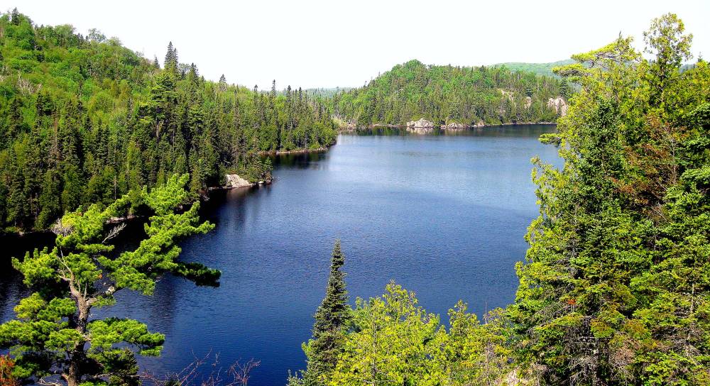
Perhaps the most photographed post on the route – dare I see even in the park – this lookout provides observers with a stunning view of Orphan Lake, and in the far distance, their first glimpse of Lake Superior on a clear day. Listen carefully, as you can often hear wildlife below, enjoying a drink at the water’s edge, or fishermen celebrating their latest catch

For the first two kilometres, the trail offers a leisurely stroll through the bush, heavily shaded by a thick forest canopy. Hikers can enjoy a break at the first lookout approximately 400 feet above Lake Superior. Perhaps the most photographed post on the route – dare I say even in the park – this lookout provides observers with a stunning view of Orphan Lake, and in the far distance, their first glimpse of Lake Superior on a clear day. Listen carefully, as you can often hear wildlife below, enjoying a drink at the water’s edge, or fishermen celebrating their latest catch, where the catch of the day ranges from Whitefish, Lake Trout, Perch, and Pyke. One of my favourite things about the Orphan Lake Trail is the echo that permeates from the lake and infiltrates throughout, creating a heightened awareness of your surroundings. You become aware of everything and everyone on the trail, whether in the company of other hikers or wildlife, including bears, deer, wolves, birds, and more.

From the first lookout, the trail begins its steady descend to Lake Superior while travelling simultaneously around the calm shoreline of Orphan Lake. Moss, lichen, mud, small streams, rocks, and boulders, make footing uneasy. In heavy rainfall, the trail is extremely slick and becomes lined with a thick gooey coating of mud, making this path also a mosquito’s paradise. (Yes, unfortunately, this trail gets overridden in the spring months with insects, so come prepared with bug repellant and even netting.)  Another lookout provides hikers with the opportunity to gaze at mighty Superior and the rugged coastline, before passing around burned down brush from a forest fire in May of 1998. Blackened maple and pine trees tower above hikers, limbless, creating a gothic and ghostly atmosphere. The smell of the charred wood still lingers.

Finally, two steep descends places hikers on the coast of Lake Superior. As already mentioned, the echo around Orphan Lake is perhaps my favourite memory from the hike. Noise travels for miles around the pond, creating a mystical atmosphere. The same rings true for Lake Superior. Prior to reaching these two final steep stretches, hikers can hear wild waves ricocheting on the shore. The sound makes one think you’re just steps from Lake Superior, when in reality, you’re miles away. The sound gets louder as the smell of freshwater becomes prominent, hinting at your proximity to Superior.

On an overcast day, the trail is dark and dreary due to the thick canopy of the forest. However, a burst light can be seen up ahead, through the tunnel of trees, signalling you’ve reached the edge of the unstable shores of Superior. The water becomes deafening, pounding the shoreline, moving the millions of fist-sized pebbles that line the water’s edge. The pebbles create the illusion of water, rolling into uneven piles, mimicking the powerful waves that caused these vast formations. During a storm, the shoreline becomes engulfed by high tides and the surf.

The mouth of the Baldhead River as seen from the Coastal Trail.

The mouth of the Baldhead River as seen from the Coastal Trail.

Hikers travel right upon reaching Lake Superior. The Baldhead River becomes the centre of attention, and a new noise becomes clear over the sound of the crashing waves and the bubbling river – the Baldhead Falls in the distance. The trail continues through the forest at the mouth of the Baldhead River, running alongside the tributary, gradually climbing until reaching the falls. The view of the falls is obstructed by the trees, but hikers can make out several drops, each scaling 10-15 feet in height, before the trail leaves the river completely and begins its vertical ascent.

Similar to the trek toward Lake Superior, the trek back to the parking lot is hindered by thick moss coverage as well as dark brown mud. After heavy rainfall, the trail becomes overrun with mud, making for a messy expedition. Coming to the aid of trail users, park staff have created small wooden bridges and trusses to travel across extremely muddy areas; however, these wooden crutches, too, often become consumed by the mud. Be prepared to be welcomed by mosquitoes through this section of the trail.

After climbing over 400 feet, hikers reach the western shore of Orphan Lake, and once again can listen for the echo of other travellers, wildlife, and fishermen. After wandering around the lake and enduring an agonizing climb, hikers can once again enjoy a leisurely stroll through the forest before returning to their car to take them to their next stop in Lake Superior Provincial Park, be it Katherine Cove to the south, or Old Woman Bay, heading north.

The Orphan Lake Trail provides access to the Coastal Trail. Hikers heading north of the Baldhead River and the Orphan Lake Trail will face gruelling hiking conditions on rugged Lake Superior.

The Orphan Lake Trail provides access to the Coastal Trail. Hikers heading north of the Baldhead River and the Orphan Lake Trail will face gruelling hiking conditions on rugged Lake Superior.

Though the Orphan Lake Trail is often described as a day hiker’s paradise, it is more than just that. It is also a backpacker’s utopia, providing access to interior of Lake Superior Provincial Park. The Orphan Lake Trail also provides access to the rugged Coastal Trail, where some of the most pristine beaches can be found. Hikers can access the Coastal Trail via the Orphan Lake Trail once they reach the pebbled beach of Lake Superior. Hikers have the option of turning either right or left upon reaching Superior. To the right, following the Orphan Lake Trail, hikers cross the Baldhead River, bypassing the Baldhead Falls, via wooden bridges constructed by staff, where they will reach one of the largest interior campsite opportunities on the trail (there are five campsites) and be greeted with rugged coastline. By turning right and heading north on the Coastal Trail, hikers will have to endure the hardest portion of the Coastal Trail, south of Gargantua, since Orphan Lake is the last access point for the Coastal Trail until Gargantau Harbour. However, with great pain comes great reward: hikers will also enjoy some of the most spectacular beaches, including Rhyolite Cove. If hikers turn left and hike south toward Agawa Bay, the trail will be difficult, climbing Baldhead Mountain before reaching the sandy beaches of Katherine Cove.

The Coastal Trail: South of the Pictographs & Sinclair Cove

Due to the intensity of this section of the Coastal Trail, man-made assists, including ladders, once helped backpackers and hikers scale large rock formations and steep cliffs. Now deteriorated, hikers are forced to endure the trail without any help.

Due to the intensity of this section of the Coastal Trail, man-made assists, including ladders, once helped backpackers and hikers scale large rock formations and steep cliffs. Now deteriorated, hikers are forced to endure the trail without any help.

As part of my continued journey to explore all of Lake Superior Provincial Park, I have set out to tackle the always difficult Coastal Trail, chunk by chunk. Earlier this summer, I survived my first stint on the Coastal Trail, hiking north of Sinclair Cove. This past weekend, I endured the hardest hike of my life, tackling the second toughest portion of the Coastal Trail, south of Sinclair Cove and the Agawa Rock pictographs. Unable to spend more than one night out under the stars this past weekend, my husband and I decided to trek to the first interior campsite south of the pictographs, only a mere two-kilometres away, spend the night, and return on Sunday via the same trail. However, this two-kilometre trek turned into a gruelling and exhausting backpacking excursion, definitely not for the faint hearted or the novice hiker.

The trip started off on a sour note, unfortunately. After our previous hike on the Coastal Trail, Jason’s pack gave out. Unable to purchase a new one in time for this weekend getaway, he was forced to use his ruck sack issued by the Canadian Armed Forces. Weighing in over 15 pounds empty, and oversized in every way possible, Jason was not all too excited about the gruelling terrain.  Plus, before we even arrived at the trail head, our beloved Springer Spaniel, Mister, who celebrated his fourth birthday the day before, decided he would experience his second bout of car sickness ever. Dog vomit on a hot summer day in a car is not ideal (especially for someone like me who also has a weak stomach). On top of all that, the weather man was horribly wrong. We had monitored the weather closely the week prior, including the day of the hike; however, being on Lake Superior, the weather is often unpredictable. Instead of the rainy, cool, overcast weather as predicted, including at 10:00am that morning when we left for the park, we instead were greeted with hot, sticky, sunny weather. The mercury hit a balmy 31 degrees Celsius by the afternoon, and the temperature continued to climb as the evening pressed on. Needless to say, we were overdressed for our hike, since we expected the temperature to hover at a comfortable 12 degrees Celsius. Thus, we began our hike not in the best situation.

After stopping at the Visitor Centre at the Agawa Bay campground in Lake Superior Provincial Park to purchase our interior camping park pass, we set out for the Agawa Rock pictographs, approximately five minutes further north on the Trans-Canada Highway. We parked the car, packed a few extra bottles of water after discovering the less than anticipated hot weather, and set out for the Coastal Trail.

Again, our bad luck continued. The Coastal Trail verges off from the Pictograph Trail, which is only a 400-metre trek. The terrain can be difficult and extremely slippery due to rocks and thick moss coverage. Having hiked the trail well over 10 times, I was certain I knew where the Coastal Trail left the popular Pictograph Trail. Apparently not. We ended up hiking half of the Pictograph Trail, which included having to ascend a serious rock staircase. Plus, Jason’s frustration with his ruck sack had already begun. For future reference, the Coastal Trail starts right near the very end of the Pictograph Trail.

The beginning of the trek on the Coastal Trail was simple, a nice jaunt through the Boreal Forest, watching our footing for the ever present tree roots. To our left stood the back side of the sky high cliff which guards the pictographs. A known habitat for Timberwolves in the area, we listened carefully for any creatures that might be stirring as we made our way around the cliff. Unlike the portion of the trail that lies north, glimpses of Lake Superior were few. On the trail northward, we spent the majority of our time rock hopping on the coast, only occasionally leaving the shoreline to avoid extreme terrain. With the south portion, we only enjoyed the immediate breeze of Lake Superior at the end of our trek, when we finally reached our campsite.

The first view of Lake Superior on the Coastal Trail, south of the Agawa Rock pictographs. To the right, the backview of the pictographs.

The first view of Lake Superior on the Coastal Trail, south of the Agawa Rock pictographs. To the right, the backview of the pictographs.

Our first glimpse of Lake Superior afforded us a stunning view of the Agawa Islands and a corner view of the Agawa Rock pictographs. A few houses dotted the Agawa Islands – I’ve always been jealous of their inhabitants as their view is spectacular and it is impossible now to purchase such slices of heavenly property. The view for both hikers on the Coastal Trail and these homeowners is truly one-of-a-kind: crystal clear, turquoise blue water, laps up against the coastline. The water, despite being so clear, shows its true depth, revealing jagged boulders and fallen trees a hundred feet below. The water is still frigid since the ice didn’t leave the area until early June this year due to thicker ice coverage. A few clouds wisp by, and their reflections are cast perfectly beneath them on mighty Superior.

Large caves and caverns, created by glacial retreat during the Ice Age, are infamous on the Coastal Trail, south of the pictographs.

Large caves and caverns, created by glacial retreat during the Ice Age, are infamous on the Coastal Trail, south of the pictographs.

After leaving our tranquil view, we are greeted with large boulder-like rock formations, which have created vast caverns and caves. The caves provide welcomed shade for us, who are already growing exhausted from the heat, as well a cool and damp sensation. The trail goes directly through the caves, some of which have an opening larger than six feet tall, others which afford barely half a foot of wiggle room. We treaded carefully, watching our steps, noting deep holes and caverns in the ground, some looking as if they were bottom-less. The caves are spectacular: they are gothicly eerie, something straight out of a graphic novel or a horror movie. Formed thousands of years ago during the last Ice Age, these caves took their shape when glaciers were retreating and melting, leaving large stones and boulders behind. The bottoms of the caves are smooth, from years and years of heavy rain flowing through them, and thick ice coverage in the winter. They are most definitely the perfect habitat for bears, who look to hibernate during the chilly winter months.

In the peak of their season, the Coastal Trail is lined with millions of blueberries, ripe for the eating. The provided us with a refreshing and nourishing snack. Beware, however, these are also a favourite snack of black bears during the season.

The Coastal Trail is lined with millions of blueberries, ripe for the eating. They provided us with a refreshing and nourishing snack. Beware, however, these are also a favourite snack of black bears during the season.

Leaving the caves, the trail continued through the forest. Yet, surprisingly, there was very little shade. Lichen, fallen pine needles, and an endless supply of blueberries lined the trail. Until we reached the shoreline, which was also where we set up camp, the Coastal Trail ascended, reaching great heights, allowing for the odd panoramic view of the Agawa Islands and Lake Superior. In the heat, the trek was utterly exhausting, and unable to catch our breaths, our stamina faltered. It wasn’t until we could finally hear Lake Superior lapping lazily against the shoreline that we were greeted with a much-welcomed descend – and breeze – to the shore and our campsite. But first, we had to scale boulders, hopping from rock to rock for 200 metres until we saw the much anticipated campsite sign, nailed to a tree. Despite being only a mere two kilometres, the hike took us an exasperated three hours.

Unlike our previous stint on the Coastal Trail, the water in the sheltered cove where we spent the night had warmed, allowing us the opportunity to cool off, and relax our tired muscles. As the heat continued to climb, we stayed in the water, enjoying the beautiful white sand that lay not even 10 steps from the shore.

Reaching the coast for the first time since heading south of the Pictographs, you are forced to boulder hop for approximately 200 metres.

Reaching the coast for the first time since heading south of the pictographs, you are forced to boulder hop for approximately 200 metres.

Our bad luck persevered come dinner. Having rushed to pack the night before, I carelessly forgot the lid to our pot to heat up our homemade chili. That wasn’t too much of an issue, until I realized I was short on water, having drank more than half of my supply for the entire weekend in the few hours we had hiked. Having to boil water in a pot without a lid is also not ideal – you’re left with a smoky flavoured liquid, full of ash and carcinogens. It’s very refreshing.

And in the morning, after falling asleep extremely early from heat exhaustion, we were welcomed by a black bear, who was also enjoying his morning drink while I ate my breakfast. With bears becoming more and more of an issue within Lake Superior Provincial Park each year, we never enter the park without protection, including bear spear, a bear whistler, and a bear banger. The banger did the trick, frightening the poor creature, who took to the dense forest for protection. Our beloved dog, also wanted to take off with the bear…

With the sun still hot in the morning, we packed up camp early and made our way back to the trail head. The hike was much easier heading north: we were constantly descending. Plus, we relied on very little upper body strength, the complete opposite of the day prior, which had my hands, shoulders, and arms in great pain. We managed to shave a solid hour off of our time, completing the trek in only two hours. This time, we were not utterly exhausted when finished

The return trek was much easier than hiking to our campsite. Rather than scaling large rock formations and slanted cliffs like the one pictured, we instead were able to descend them, requiring less upper body strength, making us less fatigued.

The return trek was much easier than hiking to our campsite. Rather than scaling large rock formations and slanted cliffs like the one pictured, we instead were able to descend them, requiring less upper body strength, making us less fatigued.

For myself, I personally enjoyed our first experience on the Coastal Trail (north of Sinclair Cove) better. As a lover of water, I enjoyed the views and endless exploring of the shoreline more than staying within the trees and forest. However, had we hiked further than just the first campsite, we would have enjoyed plenty of scenic sights on Lake Superior, as the Coastal Trail continues to hug the coastline of this large body of water.

For those interested in hiking the portion of the Coastal Trail which runs south of the Agawa Rock pictographs to the Agawa Bay campground Visitor Centre, the average hiking time for the seven-kilometre trek is six hours, and is rated extremely difficult.

The Coastal Trail: North of Sinclair Cove

Sinclair Cove has always been my absolute favourite spot within Lake Superior Provincial Park. A hidden gem to most, Sinclair Cove is popular for boaters, kayakers, and canoers, since it is one of the only boat launches within the park that has direct access to Lake Superior. For me, it’s more than just a boat launch. It boasts spectacular crystal clear greenish blue water, which ripples with the hint of the wind, and a sand and pebbled shoreline that extends into the depths of Superior. Vast mountains jut abruptly out of the water, casting long shadows over the cool water with the setting of the sun. And tall, evergreen pines, hundreds of years old, like those made famous by Canada’s Group of Seven, grow proudly surrounding the cove, providing privacy and shelter to those brave enough to try their luck on the Great Lakes.

A sailboat finds shelter in Sinclair Cove in the early morning hours.

A sailboat finds shelter in Sinclair Cove in the early morning hours.

Sinclair Cove is located at one of the most popular destinations within Lake Superior Provincial Park. To access the cove via the road, hikers and sightseers take the Agawa Rock Pictographs turn-off from the Trans-Canada Highway. Thousands frequent the pictographs yearly, but few make the continued journey down the winding hill road or via the Coastal Trail to Sinclair Cove. Its beauty is often forgotten or overshadowed by the magnificent and wondrous 400-year old symbols painted in red ochre. But backpackers, kayakers, and canoers know the truth about Sinclair Cove and never miss the opportunity to frequent this awe-inspiring and tranquil spot.

Until this past weekend, my familiarity with Sinclair Cove was only one stagnant view. A straight-out view from the boat launch. A few years back, I ventured up a rugged and not well-trodden trail, which branched off of the Coastal Trail, to a lookout which provided a bird’s eye view and breathtaking panoramic shot of Sinclair Cove. The view was simply stunning. However, this past weekend, I decided to explore the region further via the Coastal Trail.

Sunset on Lake Superior. We had this beautiful view for two consecutive nights.

My husband and I, as well as our beloved Springer Spaniel Mister, spent two beautifully warm evenings on Lake Superior, nestled away, tucked in between two large pebbled beaches, just two bays past passed Sinclair Cove. We hiked approximately three-kilometres north from Sinclair Cove on the Coastal Trail, one of Northern Ontario’s most rugged and difficult hiking experiences. The hike to our interior campsite was definitely difficult and had me second guessing my capabilities many times, but I knew the views I would be rewarded with would make everything worthwhile. We also didn’t start our hike until approximately 7:30pm, which for any hiker, is not ideal. When we had to leave the coastline due to unsurpassable cliffs for the densely thick forest, the long shadows and sinking sun made our footing hard to find at times. Luckily, the hike only took one hour, leaving us with another hour of sun before sunset to set up camp.

The Coastal Trail involves travelling over rough terrain and squeezing through narrow ravines caused by boulders left behind during glacial retreat in the Ice Age.

The Coastal Trail involves travelling over rough terrain and squeezing through narrow ravines caused by boulders left behind during glacial retreat in the Ice Age.

From scaling mountains on all fours – literally – to crossing streams, to boulder hopping (some the size of our feet, some the size of our bodies, others the size of large vehicles), to squeezing through tiny crevices, and getting lost once or twice unable to find the trail markers, the Coastal Trail lived up to its man-eating reputation. Plus, the humidity, coupled with the fearless and ruthless mosquitoes and blackflies, made the journey at times feel almost unbearable. But again, the views did not disappoint. The scrapes, hundred mosquito bites – I’m not joking, I am covered from head to toe – and bruises were worth the trek. And believe it or not, the section of the Coastal Trail just north of Sinclair Cove, though still rated expert-level and extremely difficult, is one of the easier portions of the five- to seven-day long hike. It is considered easy if you have already hiked south of Gargantua and south of the pictographs. We also lucked out with the weather – had it been raining, or had recently rained, our trek would have been impossible. The rocks, cliffs, and moss-covered areas would have been too slippery and treacherous to travel.

The view from in front our campsite, looking toward Sinclair Cove.

The view from in front our campsite, looking toward Sinclair Cove.

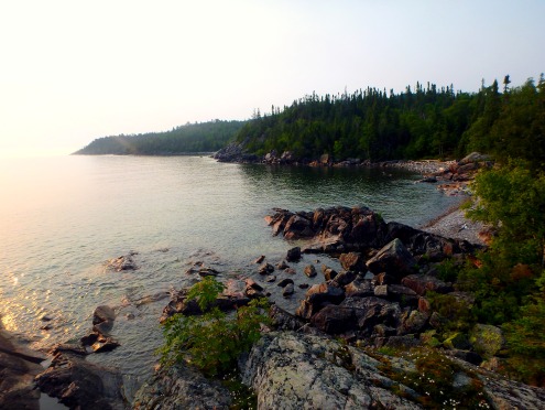
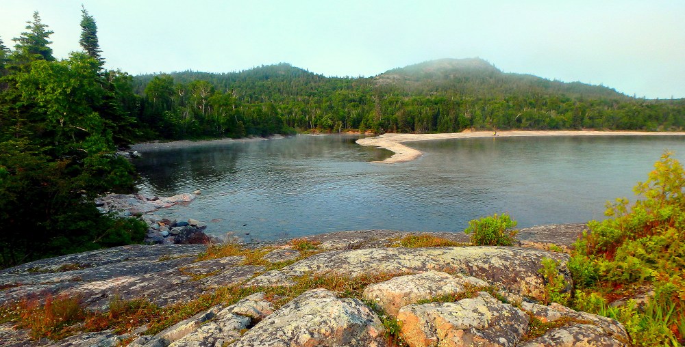
Once we reached our campsite, we immediately fell in love with the location and decided to make this our home for two nights. It was just too good to leave. Directly in front of our tent, we had our own sheltered cove, which provided a tiny glimpse of the back end of Sinclair Cove – a view I had never before seen – as well as two large islands, which have turned into a giant inlet from the lower water levels on Superior. Behind our tent, maybe 50 steps away, was another stunning view, perhaps even better. Jason thought so for sure. He deemed this the most beautiful spot within Lake Superior Provincial Park. We had views of three sheltered bays, two large islands, and in the distance (and I mean very far distance), the sandy beaches across from Pinguisibi River (Sand River). We explored the Coastal Trail further north on the second day, which included these beautiful coves. On our second night, Jason commented how perfect the location was, and how he wishes we could purchase the land for a future cottage. As much as I would love to, its better left this way for all to enjoy.

Until two nights ago, Sinclair Cove had been my favourite place within Lake Superior Provincial Park. Now, it is tied for first with this beautiful setting, located only an echo away from that pristine spot that made me want to explore the region more. Luckily for myself – and others – this beautiful location is close enough to access for a day hike, allowing me to escape the bustle of city life.

The view from behind our campsite off of the inlet that juts out into Lake Superior.

The view from behind our campsite off of the inlet that juts out into Lake Superior.

I’ve Got the Bug

I’ve got the bug. An overwhelming itch. I’ve caught the travel bug. Well, I wouldn’t say I caught it – it’s always been there – it’s just really present at the moment. I’ve already found myself planning countless trips and vacations for the remainder of 2015, and have already had to say to myself, reality check, there isn’t enough time to do all of that! What an unfortunate reality. Read More